Navigating a foreign city’s transport system can be both exhilarating and daunting. Whether you’re a seasoned traveller or embarking on your first overseas adventure, selecting the most suitable mode of transportation is crucial for a seamless experience. From efficient metro networks to innovative bike-sharing schemes, the options are as diverse as the cities themselves. This comprehensive guide delves into the intricacies of urban mobility, equipping you with the knowledge to make informed decisions and explore your destination like a local.
Urban transit systems analysis: comparing global metro networks
Metro systems serve as the lifeblood of many metropolitan areas, offering rapid transit solutions that can significantly enhance your travel experience. When comparing global metro networks, several factors come into play, including coverage, frequency, reliability, and integration with other transport modes.
Take Tokyo’s metro system, for instance. Renowned for its punctuality and extensive coverage, it sets a gold standard for urban rail networks. With trains arriving at intervals as short as two minutes during peak hours, it exemplifies efficiency in high-density urban environments. In contrast, New York City’s subway system boasts 24/7 operation, a rarity among global metros, providing unparalleled accessibility for night owls and early birds alike.
European cities like Paris and London offer their own unique advantages. The Paris Métro is celebrated for its art nouveau station designs and dense coverage within the city limits, while London’s Underground, or “the Tube”, is known for its iconic map design and extensive reach into the suburbs. Each system reflects the city’s character and historical development, influencing how tourists and locals navigate the urban landscape.
A city’s metro system is often a microcosm of its culture, efficiency, and technological advancement.
When assessing a metro network in a foreign city, consider these key aspects:
- Network coverage and station proximity to major attractions
- Frequency of trains, especially during peak tourist hours
- Ease of understanding maps and signage for non-native speakers
- Integration with other public transport modes
- Safety measures and cleanliness of stations and carriages
By evaluating these factors, you can determine whether the metro will serve as your primary mode of transport or if you should consider supplementing it with other options. Remember, the most extensive network isn’t always the most suitable for your specific travel needs.
Digital navigation tools for foreign city transport
In the age of smartphones, digital navigation tools have revolutionised the way travellers interact with foreign transport systems. These applications not only provide real-time information but also offer personalised route planning, taking into account your preferences and current traffic conditions.
Google maps vs citymapper: feature comparison for tourists
When it comes to navigating public transport in a foreign city, two apps often stand out: Google Maps and Citymapper. While Google Maps is a versatile tool available globally, Citymapper specialises in urban transport and offers more detailed features in the cities it covers.
Google Maps excels in providing comprehensive coverage across the globe, integrating various transport modes seamlessly. It offers real-time traffic updates, street view for visual confirmation of locations, and offline maps for areas with limited connectivity. However, its public transport information can sometimes lack the granularity that frequent city travellers require.
Citymapper, on the other hand, focuses exclusively on urban transport and often includes more detailed information about specific routes, including real-time arrivals, service disruptions, and even calorie burn estimates for walking portions of your journey. Its interface is tailored for public transport users , making it intuitive for navigating complex city networks.
| Feature | Google Maps | Citymapper |
|---|---|---|
| Global Coverage | Extensive | Limited to major cities |
| Public Transport Detail | Good | Excellent |
| Offline Functionality | Yes | Limited |
| Real-time Updates | Yes | Yes (more frequent in covered cities) |
Leveraging Real-Time transit data APIs in unfamiliar cities
For tech-savvy travellers, leveraging real-time transit data APIs can provide an edge in navigating unfamiliar urban environments. These APIs offer developers and third-party applications access to up-to-the-minute information on public transport services, enabling more accurate journey planning and real-time adjustments.
Many cities now provide open data platforms that include transit information. For instance, Transport for London (TfL) offers a comprehensive API that developers can use to create applications tailored to London’s transport network. This level of data accessibility allows for the creation of highly specialised apps that cater to specific needs, such as accessibility requirements or preferred modes of transport .
When using apps that tap into these APIs, you benefit from:
- Accurate arrival and departure times
- Service disruption alerts
- Dynamic route recalculation based on current conditions
- Integration of multiple transport modes for optimal journey planning
Language barriers: Multi-Lingual transport apps for international travelers
Language barriers can be a significant challenge when navigating public transport in a foreign city. Multi-lingual transport apps serve as invaluable tools for international travellers, bridging the gap between local transit information and the user’s native language.
Apps like Moovit and Rome2Rio offer interfaces in multiple languages, allowing you to plan your journey and understand transit information in your preferred language. These apps often include features such as:
- Translation of station names and route information
- Voice-guided navigation in multiple languages
- Local transport etiquette and cultural tips
By utilising these multi-lingual apps, you can navigate complex transport systems with confidence, even in cities where English is not widely spoken. This linguistic support extends beyond mere translation, often providing cultural context that can be crucial for understanding local transport norms and expectations.
Offline navigation solutions for limited connectivity scenarios
While many digital navigation tools rely on constant internet connectivity, savvy travellers know the importance of offline solutions. In foreign cities, reliable internet access isn’t always guaranteed, and international data plans can be costly. Offline navigation apps ensure that you can find your way even when your connection drops.
Apps like MAPS.ME and OsmAnd offer comprehensive offline maps that can be downloaded before your trip. These apps utilise OpenStreetMap data, which is often more detailed than other map sources, especially in less touristy areas. Offline functionality extends beyond just maps ; many of these apps include:
- Turn-by-turn navigation without an internet connection
- Offline search for points of interest
- Downloadable public transport routes and schedules
- Ability to save custom locations and create personalised maps
By preparing your device with offline navigation solutions, you ensure that you’re never left stranded, regardless of your connectivity status. This preparedness can be particularly valuable in areas with limited or expensive mobile data options.
Public transportation options: efficiency and accessibility
Public transportation forms the backbone of urban mobility in many foreign cities. Understanding the various options available and their relative efficiency and accessibility is crucial for making informed travel decisions. From buses to trams, each mode of transport offers unique advantages and challenges for international visitors.
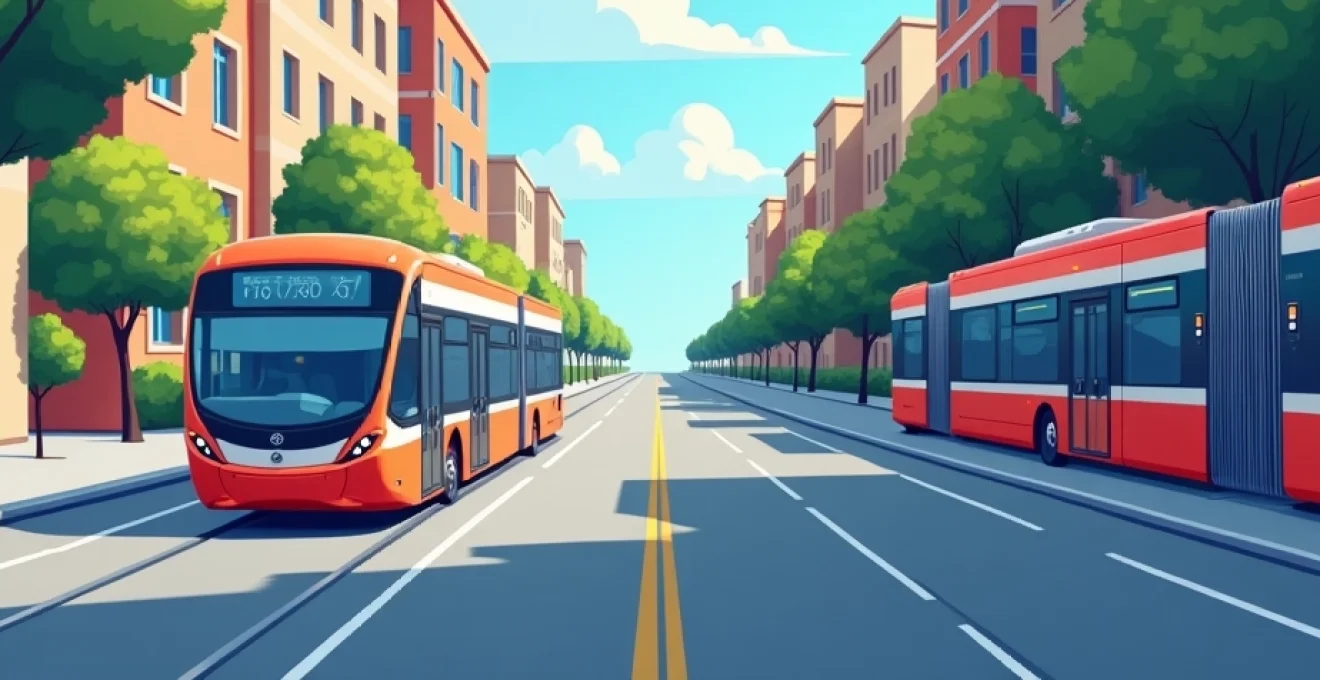
Bus rapid transit (BRT) systems: case studies from curitiba and bogotá
Bus Rapid Transit systems have revolutionised urban transport in many cities, offering metro-like efficiency at a fraction of the cost. Two cities that stand out for their innovative BRT implementations are Curitiba, Brazil, and Bogotá, Colombia.
Curitiba’s BRT system, implemented in the 1970s, is often cited as the first of its kind. Key features include:
- Dedicated bus lanes to avoid traffic congestion
- Pre-boarding fare collection to reduce dwell times
- Level boarding platforms for improved accessibility
- Integration with land-use planning for transit-oriented development
Bogotá’s TransMilenio, launched in 2000, built upon Curitiba’s model and scaled it for a larger metropolis. Notable aspects include:
- Extensive network covering much of the city
- High-capacity articulated buses
- Real-time information systems at stations
- Integration with feeder bus services for last-mile connectivity
These BRT systems demonstrate how efficient bus networks can rival rail-based transit in terms of speed and capacity. For travellers, BRT often offers a more extensive network than metro systems, particularly in rapidly growing cities where underground infrastructure may be limited.
Light rail vs heavy rail: Cost-Benefit analysis for urban mobility
When exploring a foreign city, you may encounter both light rail and heavy rail systems. Understanding the differences between these two can help you make better-informed travel decisions.
Light rail systems, such as trams or streetcars, typically operate in mixed traffic or on slightly separated rights-of-way. They offer:
- More frequent stops, ideal for short to medium-distance travel
- Lower construction and operational costs
- Easier integration with pedestrian-friendly urban designs
- Greater flexibility in route planning and expansion
Heavy rail systems, including metros and suburban railways, run on completely separated rights-of-way. Their advantages include:
- Higher capacity and speed, suitable for longer distance commutes
- Complete separation from road traffic, ensuring reliability
- Ability to serve high-density corridors effectively
- Potential for extensive underground networks in congested urban areas
From a traveller’s perspective, light rail often provides better access to city centres and tourist areas, while heavy rail excels at quickly covering longer distances, including connections to suburbs or airports. The choice between the two often depends on your specific journey and the layout of the city you’re visiting.
Integrated ticketing systems: the oyster card model in london
Integrated ticketing systems have transformed the way people use public transport, and London’s Oyster card is a prime example of this innovation. Introduced in 2003, the Oyster card system has become a model for contactless payment in public transport worldwide.
Key features of the Oyster card system include:
- Contactless payment across multiple transport modes (bus, tube, rail, tram)
- Automatic fare calculation and daily capping for cost-effective travel
- Reduced boarding times, improving overall system efficiency
- Easy top-up options online, at stations, or at numerous retail locations
For travellers, integrated ticketing systems like the Oyster card offer significant advantages:
- Convenience of a single card for all public transport needs
- Potential cost savings through fare capping and special tourist passes
- Reduced need to understand complex fare structures
- Quicker boarding times, allowing for more efficient travel
Many cities have adopted similar systems, such as Hong Kong’s Octopus card or Singapore’s EZ-Link. When planning your trip, research whether your destination offers integrated ticketing and consider purchasing a card for the duration of your stay. The convenience and potential cost savings can significantly enhance your travel experience .
Accessibility features for disabled travelers in global transit networks
Accessibility in public transport is an increasingly important consideration for cities worldwide. For disabled travellers, understanding the accessibility features of a foreign city’s transit network is crucial for planning a comfortable and inclusive journey.
Progressive cities are implementing a range of accessibility features, including:
- Step-free access at stations and stops
- Tactile paving and audio announcements for visually impaired users
- Wheelchair spaces and priority seating on vehicles
- Staff training in assisting passengers with disabilities
When researching your destination, look for information on accessibility features and services. Many transit authorities now provide detailed accessibility guides and offer specialised assistance services that can be booked in advance.
Accessible public transport is not just a convenience; it’s a fundamental right that enables all travellers to explore and experience foreign cities fully.
Remember that accessibility standards can vary significantly between countries and even between different transport modes within the same city. Always check the most up-to-date information and consider contacting the local transit authority directly if you have specific accessibility requirements.
Ride-hailing and Bike-Sharing services in foreign destinations
The rise of ride-hailing and bike-sharing services has added new dimensions to urban mobility, offering flexible alternatives to traditional public transport. These services can be particularly useful for travellers, providing on-demand transportation and the freedom to explore at your own pace.
Ride-hailing services like Uber and Lyft have expanded globally, but it’s important to note that availability and regulations vary by country. In some cities, local alternatives may be more prevalent or offer better service. For instance, Grab dominates the Southeast Asian market, while DiDi is the go-to option in China.
When using ride-hailing services in a foreign city, consider these factors:
- Local regulations and licensing requirements for drivers
- Safety features such as in-app emergency buttons or driver background checks
- Pricing structure, including surge pricing during peak hours
- Integration with local payment methods
Bike-sharing schemes have also proliferated in cities worldwide, offering an eco-friendly and often cost-effective way to navigate urban areas. These systems typically fall into two categories:
- Station-based systems where bikes must be picked up and returned to designated docks
- Dockless systems allowing bikes to be left at any appropriate location within the service area
When considering bike-sharing, evaluate the following:
- Coverage area and availability of bikes in tourist-heavy locations
- Pricing structure, including any tourist-friendly pass options
- Quality and maintenance of the bikes
- Availability of cycling infrastructure such as dedicated lanes
Both ride-hailing and bike-sharing can complement traditional public transport , offering solutions for last-mile connectivity or travel outside of main transit corridors. They can be particularly useful in areas with limited public transport coverage or during off-peak hours when regular services may be less frequent.
Walking and cycling infrastructure assessment techniques
Assessing the walking and cycling infrastructure of a foreign city is crucial for travellers who prefer active modes of transport. A well-developed pedestrian and cycling network can significantly enhance your exploration of a new destination, providing both health benefits and intimate city experiences.
When evaluating a city’s walking infrastructure, consider the following aspects:
- Width and condition of sidewalks
- Presence of pedestrian crossings and traffic signals
- Street lighting for night-time safety
- Availability of pedestrianised zones in city centres
- Wayfinding signage for tourists
For cycling infrastructure, key elements to assess include:
- Presence of dedicated cycling lanes or paths
- Quality of road surfaces for cycling
- Availability of bike parking facilities
- Integration with public transport (e.g., bike racks on buses)
- Bike-sharing scheme coverage and accessibility
Many cities now provide cycling maps highlighting recommended routes and facilities. These can be invaluable resources for tourists looking to explore on two wheels. Additionally, some cities offer guided cycling tours, which can provide a safe and informative introduction to the local cycling infrastructure.
When assessing a city’s walkability and bikeability, consider using tools like Walk Score or similar local equivalents. These platforms provide numerical ratings based on proximity to amenities and quality of infrastructure, offering a quick overview of a neighborhood’s pedestrian-friendliness.
Intermodal transportation strategies for seamless city exploration
Intermodal transportation combines multiple modes of transport in a single journey, offering flexibility and efficiency for city exploration. Understanding and utilizing intermodal strategies can significantly enhance your travel experience in a foreign city.
Park-and-ride facilities: integrating private and public transport
Park-and-Ride facilities are a prime example of intermodal transportation, allowing travelers to combine private vehicle use with public transit. These facilities typically offer parking lots near public transport hubs, enabling visitors to drive to the outskirts of a city and then use more efficient public transport to reach the city center.
Benefits of Park-and-Ride for travelers include:
- Reduced stress of driving in unfamiliar urban traffic
- Cost savings on city center parking fees
- Avoidance of congestion charges in cities that implement them
- More environmentally friendly option compared to driving into the city
When planning to use Park-and-Ride facilities, consider:
- Location of facilities in relation to your accommodation and intended destinations
- Operating hours and security measures at parking lots
- Frequency and reliability of connecting public transport
- Total cost compared to other transport options
Transit-oriented development (TOD) impact on tourist mobility
Transit-Oriented Development is an urban planning approach that concentrates housing, commercial spaces, and amenities around public transport hubs. For tourists, TOD areas can offer convenient and accessible bases for city exploration.
Key advantages of staying in or near TOD areas include:
- Easy access to multiple transport modes
- Walkable neighborhoods with diverse amenities
- Reduced need for private vehicle use
- Often vibrant, mixed-use environments that showcase local culture
When selecting accommodation, consider proximity to TOD areas for a more integrated travel experience. Many modern city guides now highlight these transit-centric neighborhoods as ideal locations for visitors.
Multimodal journey planners: algorithms and user experience design
Multimodal journey planners have revolutionized the way travelers navigate foreign cities. These sophisticated tools use complex algorithms to integrate data from various transport providers, offering comprehensive door-to-door route planning.
Key features of advanced multimodal journey planners include:
- Real-time updates on service disruptions and delays
- Comparison of routes based on time, cost, and environmental impact
- Integration of walking, cycling, public transport, and ride-sharing options
- Personalization based on user preferences (e.g., minimizing transfers or avoiding stairs)
When choosing a multimodal journey planner for your trip, consider factors such as:
- Coverage of your destination city
- User interface intuitiveness, especially for non-native language speakers
- Offline functionality for use without data connectivity
- Integration with local ticketing systems for seamless travel
First Mile/Last mile solutions in tourist-heavy urban areas
First Mile/Last Mile (FMLM) solutions address the challenge of getting travelers from their starting point to the main public transport network and from the network to their final destination. In tourist-heavy areas, effective FMLM solutions can significantly enhance the visitor experience.
Common FMLM solutions in urban tourist areas include:
- Bike and e-scooter sharing schemes
- On-demand shuttle services
- Pedestrian-friendly infrastructure and wayfinding systems
- Integration of ride-hailing services with public transport apps
When planning your urban exploration, consider how you’ll navigate the first and last mile of your journeys. Many cities now offer tourist-specific FMLM options, such as hop-on-hop-off buses or guided walking tours that connect major attractions with transport hubs.
By understanding and utilizing intermodal transportation strategies, you can create a more seamless and enjoyable exploration of foreign cities. Remember that the best approach often combines multiple modes of transport, adapting to the unique characteristics and offerings of each destination.